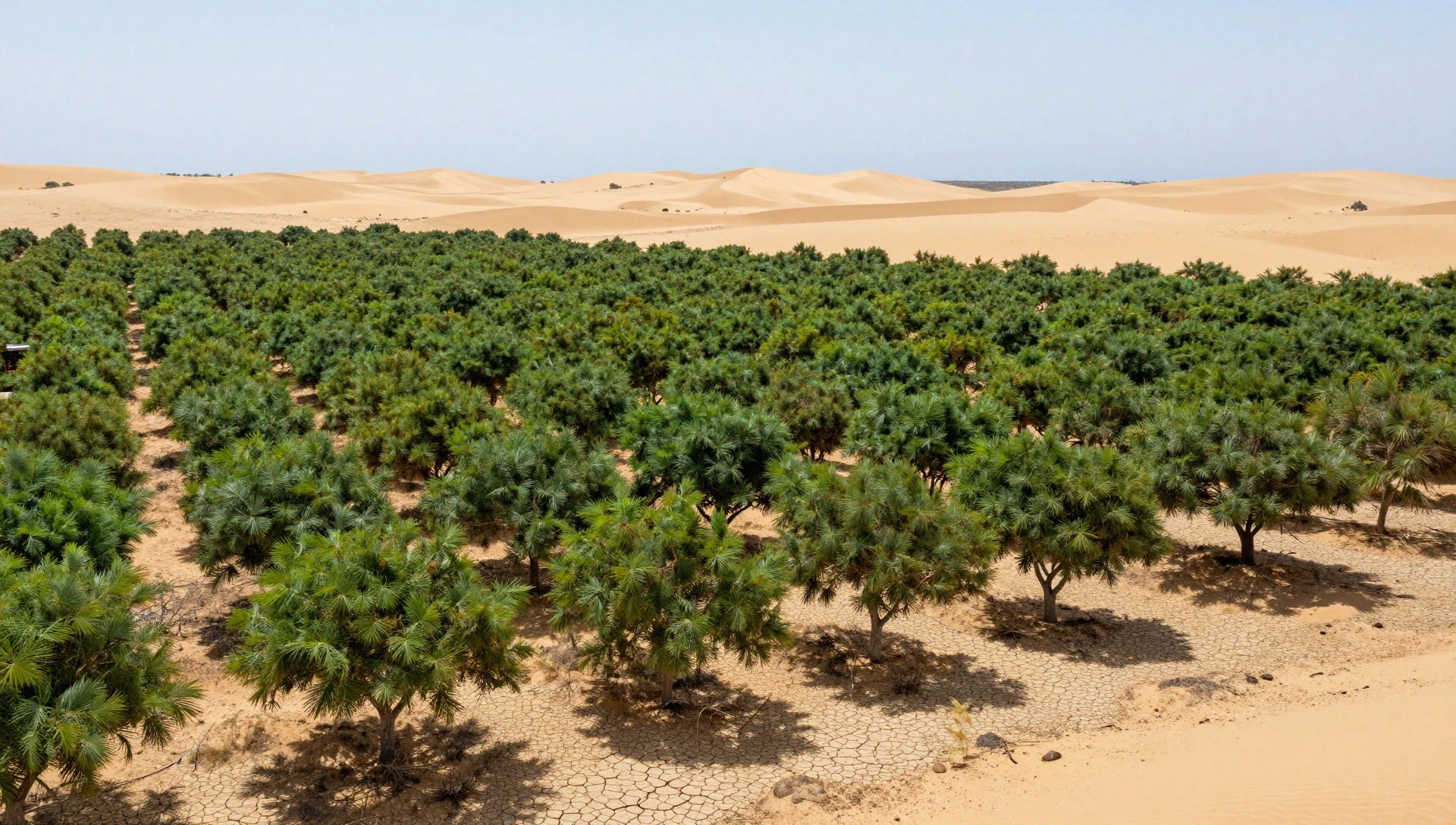
Ascension Island sits in the South Atlantic roughly 1,600 kilometres from Africa and about 2,000 kilometres from Brazil, with Saint Helena as its nearest neighbour some 1,300 kilometres away.
When British sailors reached it in 1815, they found a volcanic outcrop so devoid of vegetation that the Royal Navy classified it as a ship rather than a territory.
Two centuries later, the upper slopes of Green Mountain carry banana plants, ferns, mosses, giant bamboo and mature fig trees, a transformation that has turned a geological curiosity into a live experiment in ecological engineering.
On This Page
The island's isolation explains both its barrenness and the significance of its greening. No seed-bearing plant reached Ascension before human arrival, because prevailing winds and ocean currents could not bridge the distance from any continent. Every species now growing there was introduced, deliberately or accidentally, by people.
That makes the resulting forest one of the few fully documented cases of a man-made ecosystem assembled from scratch, and it is precisely this provenance that draws researchers studying desertification on far larger landmasses.
Víctor Maull, a Spanish scientist working on the island, is testing how vegetation established itself across an altitudinal gradient that shifts from dry coastal lowland to woodland and then to dense cloud-fed forest.
Charles Darwin visited in 1836 aboard HMS Beagle and described the terrain as bleak, comparing it to the starkest Welsh mountains while speculating that water had once flowed there.
The contrast between Darwin's account and the green mountain today frames the central question: whether engineered vegetation can be replicated where land is degrading.
TL;DR Ascension Island was barren when Britain occupied it in 1815, and every plant now growing there arrived through human intervention. The resulting man-made forest on Green Mountain, studied today by Spanish researcher Víctor Maull, offers a documented case of rapid ecological transformation on isolated volcanic terrain. Scientists are examining whether the mechanisms behind that greening — species introduction, altitude-driven moisture capture and soil formation — hold lessons for combating desertification elsewhere. The evidence is promising but contested, because a forest assembled from introduced species is not automatically a model for restoring degraded drylands.
The Barren Island That Became a Forest
Ascension's modern landscape is the product of a specific historical sequence rather than gradual natural colonisation. Britain garrisoned the island in 1815, fearing France might seize it as a staging post after Napoleon's exile to Saint Helena.
The garrison needed water, fuel and food, and the Royal Navy began planting trees to increase rainfall on the summit. What followed was an unplanned accumulation of introductions spanning more than a century, from ornamental shrubs to food crops, each finding a niche on the volcano's moist upper slopes.
Geography and the Absence of Native Flora
Ascension lies near the Mid-Atlantic Ridge, and its volcanic soils are young, thin and mineral-rich but poor in organic matter. The island's climate is dominated by steady trade winds and limited rainfall concentrated at higher elevations.
These conditions produced a lowland of lava, cinder and sparse scrub, with almost no vascular plants recorded before 1815. Isolation, not infertility, was the binding constraint on colonisation.
Distance is the decisive variable. At more than 1,000 miles from Africa and Brazil, Ascension received no wind-borne seeds and no bird-mediated dispersal of consequence. The nearest land, Saint Helena, itself hosts a flora shaped by similar isolation.
Any species reaching Ascension therefore arrived in a ship's hold, on a sailor's boot or in a cargo of soil, which is why the island's botanical record is effectively a catalogue of human transport.
Darwin's 1836 description captures the baseline. He called the island bleak and compared its ridges to the starkest Welsh mountains, yet he also reasoned that water must once have existed there, inferring past moisture from the terrain itself.
That observation anticipated the modern finding that altitude, not latitude, governs where vegetation can persist on the island.
The Green Mountain Experiment
Green Mountain rises to roughly 859 metres and intercepts moisture carried by the southeast trade winds, creating a cloud belt that sustains vegetation the surrounding lowlands cannot support. Nineteenth-century planting concentrated on this summit, and the result is a dense, layered woodland that now shades its own understorey. The mountain functions as a natural condenser, and the forest amplifies that effect.
Maull's fieldwork traces the transition from dry lowland through woodland to closed-canopy forest, documenting how introduced species assembled into something resembling a functioning ecosystem. Banana plants, ferns, mosses, giant bamboo and large fig trees coexist on volcanic substrate, and a pond has formed within the vegetated zone.
The sequence matters because it shows how quickly structural complexity can emerge when water and propagules are both available.
The engineering dimension is explicit. Planting was a deliberate intervention intended to increase water yield, and the forest that resulted was an unintended consequence of that policy. Ascension therefore represents a case where human management produced a self-sustaining ecosystem without a restoration plan, a distinction that separates it from contemporary ecological engineering projects with defined targets and monitoring regimes.
Darwin's Observation and Modern Science
Darwin's speculation about past water on Ascension has been partly vindicated by evidence of former springs and by the moisture regime that now supports the summit forest. His account also establishes a documented baseline against which two centuries of change can be measured, a rarity in ecological history. Few islands offer such a clear before-and-after record written by a credible observer.
Contemporary research reframes the island as a test case for understanding how vegetation alters local hydrology. Forest cover increases fog interception and reduces evaporation from soil, which can raise water availability at higher elevations.
On Ascension, this feedback appears to have reinforced the conditions that allowed the forest to persist, though the magnitude of the effect remains debated among hydrologists.
The scientific value lies in the completeness of the record. Because every species was introduced and the timeline is documented, researchers can separate the effects of species composition from those of climate and substrate.
That control is unavailable in most continental settings, where colonisation histories stretch over millennia and cannot be reconstructed with comparable precision.
We Also Published
What the Ascension Forest Teaches About Desertification
Desertification is conventionally defined as land degradation in arid, semi-arid and dry sub-humid areas, driven by climatic variation and human activity. The United Nations Convention to Combat Desertification estimates that roughly a quarter of the global land surface is affected, with consequences for the livelihoods of more than a billion people.
Ascension is not a dryland in the conventional sense, but its transformation illustrates the mechanisms that determine whether vegetation can establish on degraded terrain.
Mechanisms of Vegetation Establishment
Three conditions govern whether plants colonise barren ground: a source of propagules, sufficient moisture, and a substrate capable of retaining water and nutrients. Ascension lacked the first entirely and possessed the second only at altitude.
Human introduction supplied the missing propagules, and the cloud belt supplied moisture, which together allowed the third condition to develop as leaf litter accumulated into soil.
The feedback loop is the critical insight. Once vegetation establishes, it modifies its own environment by shading soil, reducing evaporation and adding organic matter. On Ascension, forest cover appears to have increased fog interception, raising moisture availability and reinforcing the conditions for further growth. This positive feedback is what allows a small initial intervention to produce a disproportionately large ecological shift.
Altitude substitutes for rainfall in this model. Green Mountain's cloud belt delivers water through interception rather than precipitation, a mechanism also observed in montane forests from the Canary Islands to the Andes.
For dryland restoration, the implication is that site selection matters as much as species choice, because moisture capture depends on topography and prevailing winds.
Limits of the Analogy
The analogy to desertification has clear boundaries. Ascension's forest is composed almost entirely of introduced species, several of which are invasive in other contexts, and its establishment was unplanned. Dryland restoration projects typically aim to restore native vegetation and ecosystem services, objectives that a novel assemblage of introduced plants may not serve. Transferring the Ascension model wholesale would be scientifically unsound.
Scale is a further constraint. Ascension covers roughly 88 square kilometres, and its vegetated zone is a fraction of that. Continental drylands span millions of square kilometres and involve complex land tenure, grazing pressure and groundwater dynamics that an isolated island does not face. Mechanisms may transfer; management prescriptions do not.
Water budgets also differ. Ascension's forest depends on atmospheric moisture intercepted at altitude, a subsidy unavailable across most flat, arid terrain. Restoration in the Sahel or the Thar Desert must work within rainfall regimes of 100 to 600 millimetres annually, where the margin for error is far narrower than on a cloud-wrapped volcanic summit.
Policy Implications for Dryland Restoration
The most transferable lesson is procedural rather than botanical. Ascension demonstrates that vegetation establishment depends on removing the binding constraint, which in that case was propagule supply. In drylands, the binding constraint is usually water retention and grazing pressure, and interventions that address those directly tend to outperform broad planting campaigns.
Monitoring matters equally. The island's transformation was documented because naval records, Darwin's account and subsequent surveys created a longitudinal record. Contemporary restoration programmes that lack baseline data cannot distinguish genuine recovery from short-term fluctuation, a weakness that undermines both evaluation and adaptive management.
Expectations should be calibrated to timescales. Ascension's forest took roughly a century to reach structural maturity, a span that exceeds most political and funding cycles. Programmes promising rapid greening of degraded land invite disappointment, whereas those framed around decades align better with how ecosystems actually assemble.
- 01
- 02
- 03
- 04
The Scientific and Strategic Significance
Ascension's value extends beyond its own shores. Islands function as natural laboratories because their boundaries are defined and their histories often documented, allowing researchers to test ecological theory under controlled conditions.
The Ascension case contributes to a broader literature on novel ecosystems, assemblages of species that have no historical precedent but function as self-sustaining systems. Understanding such systems matters as climate change reshuffles species distributions worldwide.
Islands as Ecological Laboratories
Island biogeography has long used isolated landmasses to study colonisation and extinction, and Ascension adds a case where colonisation was entirely anthropogenic. That distinction allows researchers to isolate the role of human transport from natural dispersal, a separation rarely possible on continents. The island thus informs debates about how quickly ecosystems can assemble when dispersal barriers are removed.
The documented timeline strengthens the case. Because planting records and visitor accounts span two centuries, researchers can correlate specific introductions with subsequent ecological change. Few sites offer such granularity, and the resulting dataset has value for modelling how introduced species interact with substrate, moisture and each other over decadal scales.
Novel ecosystems are increasingly common globally, from abandoned farmland to urban woodlands. Ascension provides an unusually clear example of how such systems develop without deliberate design, which helps managers anticipate outcomes when restoration targets cannot be met with historical species assemblages.
Geopolitics of a Remote Outpost
Ascension's strategic position has shaped its environmental history. Britain occupied it in 1815 to deny France a base, and the island later served as a communications and staging facility during the Falklands conflict.
Its isolation, once a liability, became an asset for cable stations, satellite tracking and military logistics, all of which sustained the human presence that transformed the landscape.
The garrison's need for water drove the planting programme, making the forest a byproduct of imperial logistics rather than conservation. That origin is analytically important because it shows how strategic imperatives can produce large-scale environmental change as a side effect. Contemporary infrastructure projects carry similar potential for unintended ecological consequences.
Today the island hosts a small population and limited infrastructure, and access remains restricted. That constraint has protected the forest from the development pressure that afflicts many inhabited islands, preserving it as a research site while limiting the scope of on-the-ground study.
Lessons and Cautions
The Ascension story resists simple moralising. It is neither a triumph of ecological engineering nor a cautionary tale about invasive species, but both simultaneously. The forest supports endemic invertebrates and provides water-capture services, yet it also displaced the island's sparse native flora and depends on continued moisture interception at altitude.
For desertification policy, the defensible conclusion is that removing the binding constraint on vegetation establishment can trigger rapid change, but that the resulting ecosystem may differ substantially from any restoration target. Planners should therefore specify desired outcomes precisely and monitor for unintended assemblages rather than assuming that greening equals success.
The broader lesson concerns humility about timescales and control. Ascension's forest emerged from a century of uncoordinated introductions and climatic accident, not from a master plan. Restoration programmes that acknowledge uncertainty and build in long monitoring horizons are more likely to learn from outcomes than those that declare success at the point of planting.
From our network :
- The Hidden Cost of AI Convenience: Why Over-Permissioned Agents Are a Security Time BombDiscover why AI agents with excessive permissions create dangerous single points of failure, and learn how implementing least privilege principles can protect your organization from exploitation.
- Mobile Learning and VR in English: What Global Evidence Reveals About Effective Language TechnologyA systematic review across 14 countries reveals which language-learning technologies genuinely work. Mobile learning, AI, and VR show measurable benefits when pedagogically integrated. This evidence-based guide helps educators and learners select technology that delivers real return on investment.
- University Language Proficiency Exams: Why Institutional Tests Demand Different Preparation Than IELTS and TOEFLDiscover why university-specific language proficiency examinations differ fundamentally from IELTS and TOEFL, and learn strategic preparation approaches for institutional assessment success.
- Live Online English Classes for Kids: Do They Actually Reduce Anxiety?A ten-week study reveals that synchronous online English classes can significantly reduce child language anxiety while improving listening and reading skills. Discover what makes these programs effective and how parents can select the right one.
- Committed Mediterranean Precipitation Decline: Why Emissions Cuts Alone Cannot Restore Winter RainsNew NOAA research reveals that Mediterranean winter rains may decline irreversibly even with emissions cuts. Explore the science of committed climate change and regional impacts.
- How AI Agents Will Change the Way We Manage Personal FinancesExplore how AI agents are transforming personal finance through automated budgeting, bill payment, and investment management, while examining the critical security protocols and governance frameworks required for safe deployment.
- The Final Descent: How ESA Retired the Legendary Cluster Constellation After 24 Years of Space Weather ScienceAfter 24 years mapping Earth’s magnetosphere, ESA’s Cluster mission concluded with a precisely controlled reentry over the South Pacific. This analysis explores the scientific legacy, engineering decisions, and debris mitigation principles behind one of space exploration’s most responsible retirements.
- CISA’s Ten-Advisory Wave: Why Generic Patching Fails in OT and How to Build Product-Specific PlaybooksCISA released ten ICS advisories in one week, exposing critical infrastructure risks. Generic patching fails in OT. Learn to build product-specific remediation playbooks.
- Forbidden Matrix Patterns and Visible Lattice Points: A Geometric DictionaryExplore how multidimensional 0–1 matrices encode geometric truths, linking forbidden patterns to visible lattice points and hypergraph theory, with applications in combinatorics and computational geometry.
RESOURCES
- Darwin's best-kept secret : r/science - Redditreddit.comSep 1, 2010 ... Ascension Island Ascension is one of a number of volcanic islands ... The outcome, however, is not a man-made tropical…
- Population density and habitat use of the yellow land crab ...link.springer.comAug 7, 2026 ... Several land crab species inhabit oceanic islands worldwide, where they often dominate terrestrial arthropod communities, and act as ...
- Could a desert region develop rainfall if you covered it in plants and ...reddit.comAug 23, 2026 ... ... caused the desertification, they can reverse it (in most cases). Amusingly, in every documentary I've seen about reversing a…
- Tropical and Boreal Forest – Atmosphere Interactions: A Reviewb.tellusjournals.seMeasurements made by the US Department of Energy Atmospheric Radiation Measurement (DoE ARM) Mobile Facility at Ascension Island showed an SSA500 of 0.78 to ...
- Inside The Lab Growing Mutant Bacteria To Terraform Earthnoemamag.comJul 28, 2026 ... Increasing desertification now means large parts of Earth are becoming inhospitable. Can gene-edited bacteria save our planet from drying ...
- Africa: A Framework for Integrated Coastal Zone Managementdocuments1.worldbank.orgAscension Island is a 'globally important nesting 'beach for green turtles, with ... Man-Made Factors Influencing their Distribution, Abundance and Capacity for.
- Biodiversity: the UK Overseas Territoriesnonnativespecies.orgAscension Island. Journal of Applied Ecology, 1: 219–251. Hunter, B., ed ... forest must be made in the event of attempts to revoke or…
- Local Expertise Drives Global Research in Brunei Rainforestslinkedin.comOct 7, 2026 ... ... Desertification #GlobalChange #Ecology by Ascension Island Government (https://lnkd.in/ebj4BTS5). No alternative text description for this ...
- Effects of deforestation on humans and the environmentthehumaneleague.orgSep 21, 2021 ... Forests help make the planet livable for us all, but human activity is destroying them at an alarming rate. Deforestation…
- Climate Change and Biodiversity in the European Union Overseas ...portals.iucn.orgdependent sex determination of Ascension Island green turtles. Marine ... of an island, or a fossil island, made up of a ring of reef…
- Elon Musk - El Pais in English - EL PAÍSenglish.elpais.comAscension, the desert island that became a jungle · Patricia Fernández de Lis ... desertification elsewhere on the planet. A Spanish scientist has set ...
- Warfare in a Fragile World: Military Impact on the Human Environmentsipri.orgforest type made up only 76, per cent of the total spraying of woody ... Man's effects on island ecosystems. In: Farvar, M. T.…
- Could you turn the Australian outback into a rainforest by dumping ...quora.comApr 8, 2021 ... When Charles reached Ascension Island, in the finale months of his ... Is it possible to Terraform the Australian outback…
- Placing Gender Equality at the Center of Climate Actionopenknowledge.worldbank.orgWomen's informal contributions, workforce participation, remuneration, and decision-making power across sectors are unequal relative to those of men.
- 01
- 02
- 03
- 04
- 05
- 06
- 07
- 08
0 Comments